
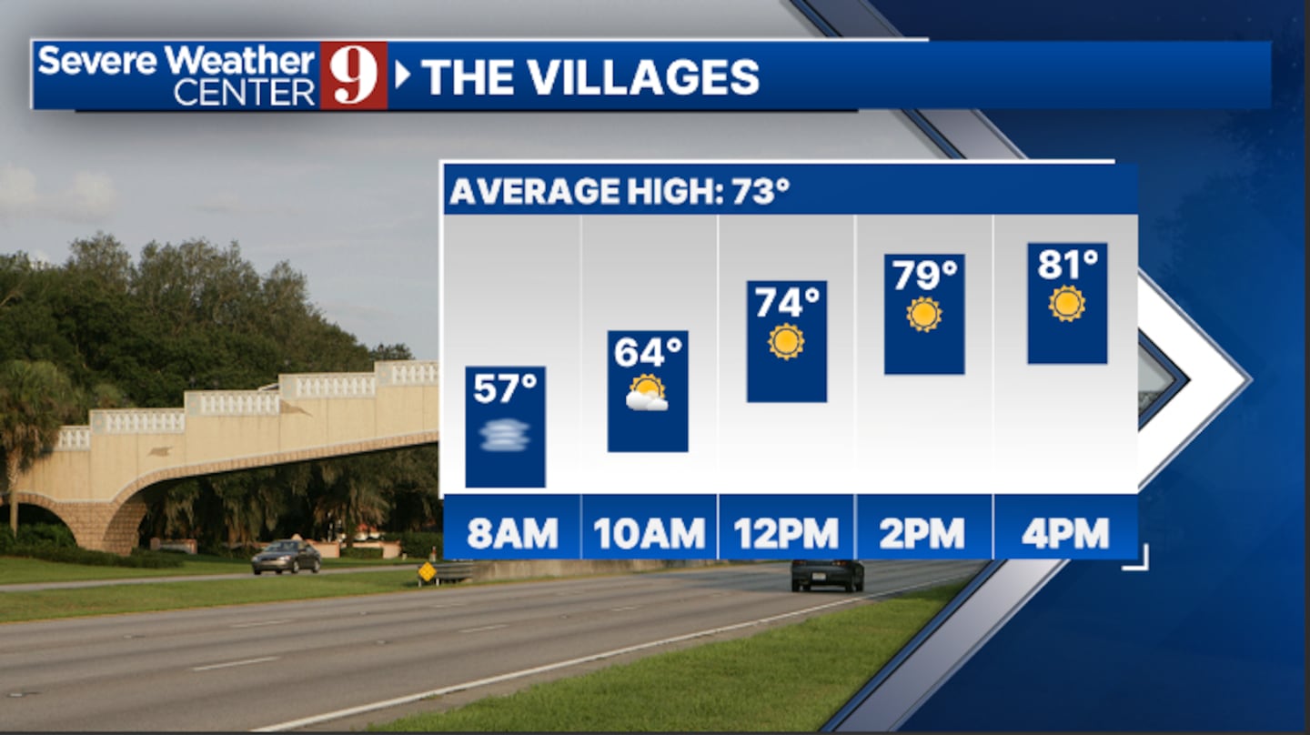
ORLANDO, Fla. — Once again, we’re starting the day with low clouds and fog, but sunshine and warm temperatures are expected in the afternoon.
▶ WATCH CHANNEL 9 EYEWITNESS NEWS
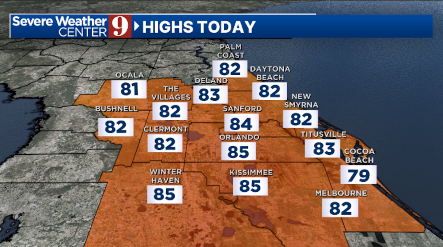
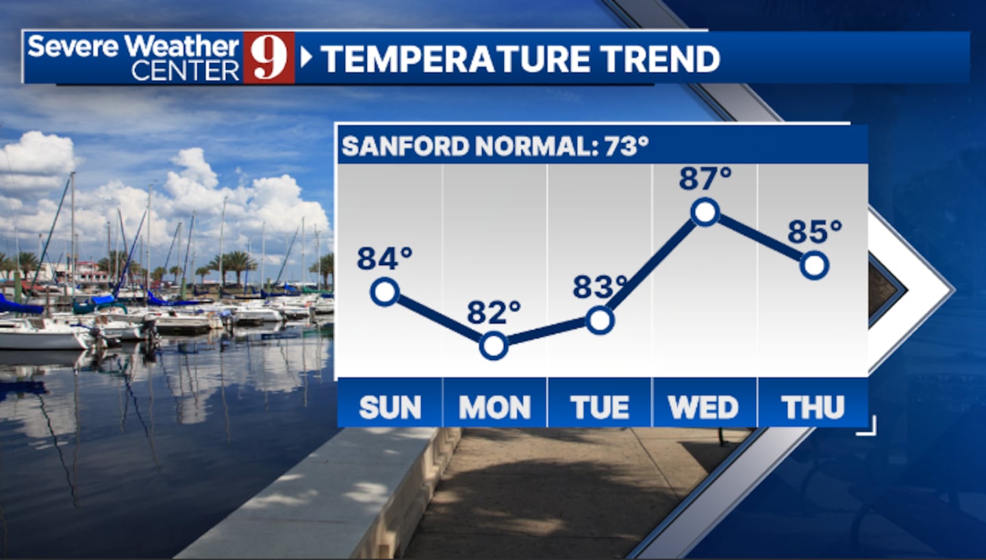
After the fog exits, we’ll see partly cloudy skies and dry conditions. Highs will close out the weekend in the mid-80s.
The threat of low clouds and fog will return later tonight, with morning lows in the low 60s.
Read: Deputies shoot, kill man in Orange County, Sheriff’s office says
Some increased moisture begins to arrive on Monday. A few sprinkles now look possible in the PM hours, with temps back in the mid-80s.
A few spotty showers will also be possible on Tuesday, but most of the area will stay dry. Tuesday’s highs will be in the mid-80s.
Read: Hundreds protest in Orlando against the Trump Administration’s policy crackdowns
Even warmer weather is expected midweek. On Wednesday, we’ll see a blend of sun and clouds, with temperatures soaring into the upper 80s.
Our first cold front of the week begins to arrive late this week. This will result in increased clouds and a few showers possible on Thursday and Friday. Highs on Thursday will be in the upper 80s, with low 80s returning on Friday.
Click here to download our free news, weather and smart TV apps. And click here to stream Channel 9 Eyewitness News live.

©2025 Cox Media Group


 Sign Up


