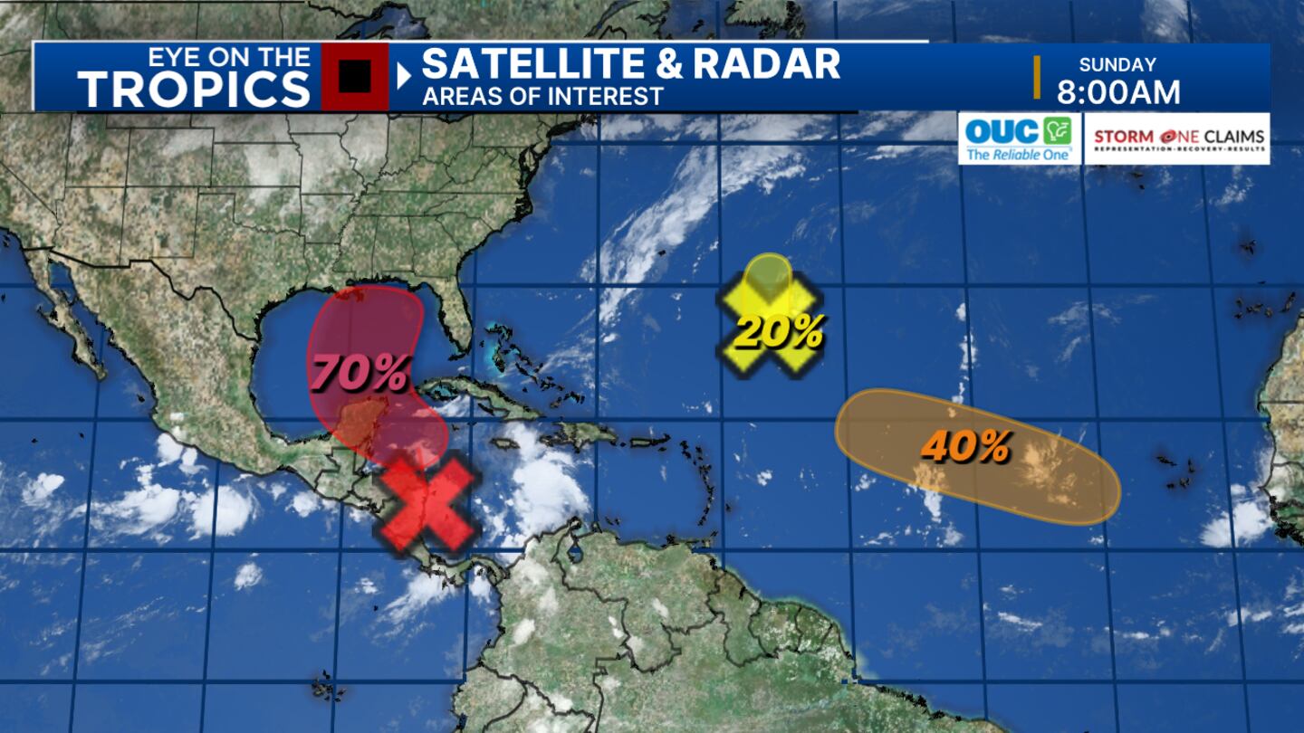
ORLANDO, Fla. — In total we are monitoring 3 areas of interest. The first 2 areas are in the open Atlantic.
▶ WATCH CHANNEL 9 EYEWITNESS NEWS
Invest 96L has a very low chances of development (20%) while a tropical wave further out in the Atlantic has a 40% chance of developing.
For both of these areas, regardless of development will most likely NOT be a concern for us here in Central FL.
The 3rd location; we are keeping a MUCH closer eye on.
Read: First day of Fall brings in warm and dry skies Sunday morning
By Tuesday and Wednesday an area of low pressure will likely form in the Western Caribbean. Once it develops we’ll be able to fine tune track and intensity.
There are a lot of uncertainties right now with this system. By the middle of the week, we will likely have a Tropical Depression or Tropical Storm lifting northward into the Gulf Of Mexico where further development will be possible. Next storm name, Helene.
Read: Grand prize winner removed 20 Burmese pythons from the wild in Florida challenge
Follow our Severe Weather team on X for live updates:
Click here to download our free news, weather and smart TV apps. And click here to stream Channel 9 Eyewitness News live.
©2024 Cox Media Group


